£10.70
FREE UK Shipping*
✓ In stock
* Allow 7-10 business days for delivery, usually by Royal Mail Tracked 48 or Second Class Post.
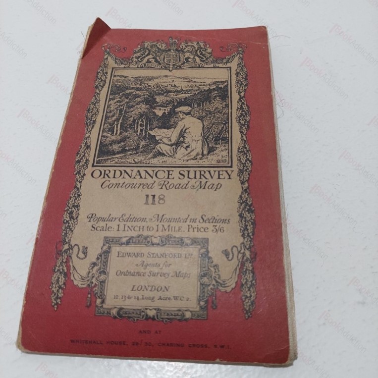
Ordnance Survey Contoured Road Map 118 : Barnstaple and Exmoor
| Binding: | Softcover |
| Volume Condition: | Good |
| Dust Jacket: | No |
| Dust Jacket Condition: | N/A |
| Language: | English |
| Publisher Name: | Edward Stanford |
| Publication Year: | 1930 |
| Publication Place: | UK |
| Book ID: | 004284 |
| Catalogue(s): | Local Interest and History - South West |
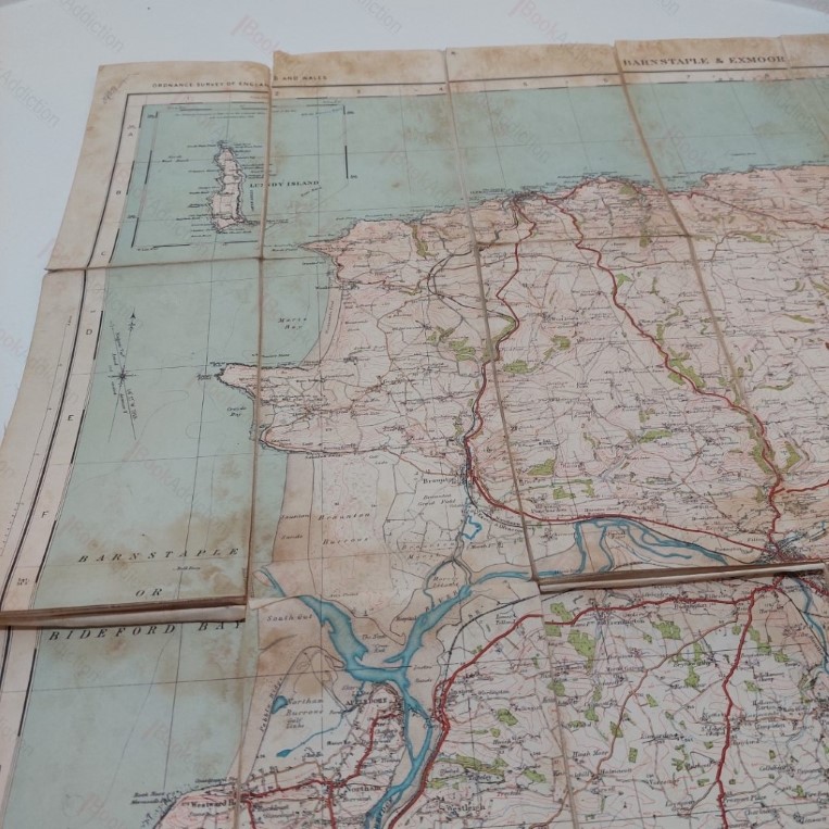
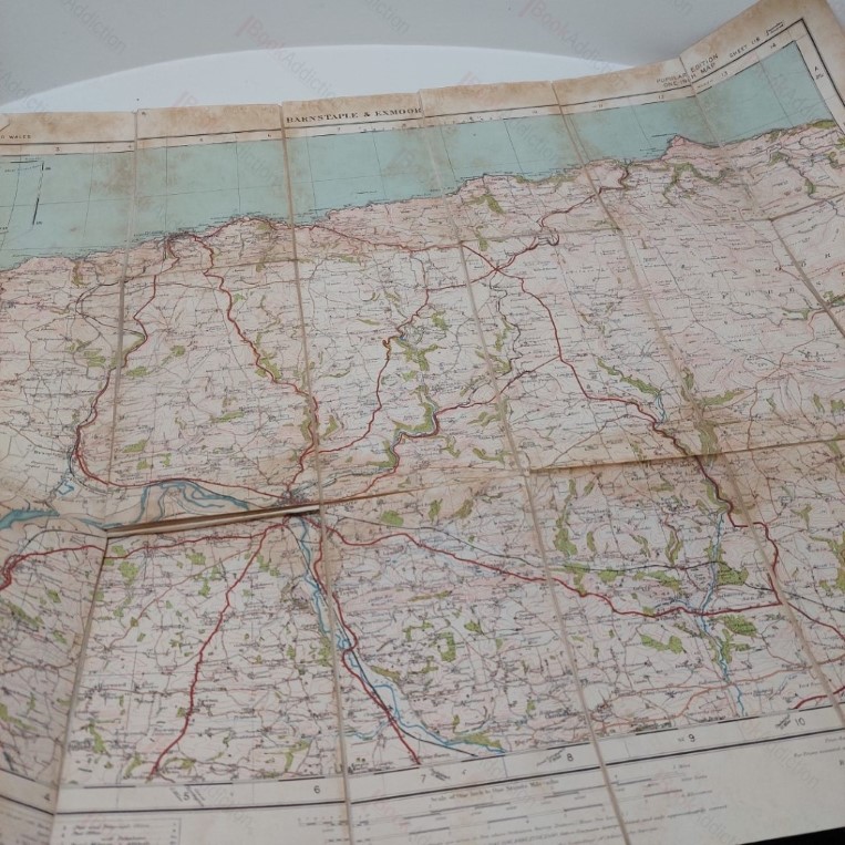
One inch to one mile Ordnance Survey contoured road map showing the Barnstaple and Exmoor area, revised in 1930 and based on a survey of 1888. Coloured map, linen-backed and mounted in sections. Map roughly centred on Shirewell, Goodleigh and Bratton Fleming. Rubbed at edges and folds, card covers rubbed at edges and faded.
Keywords:
exmoor
maps
devon
barnstaple
bratton fleming